

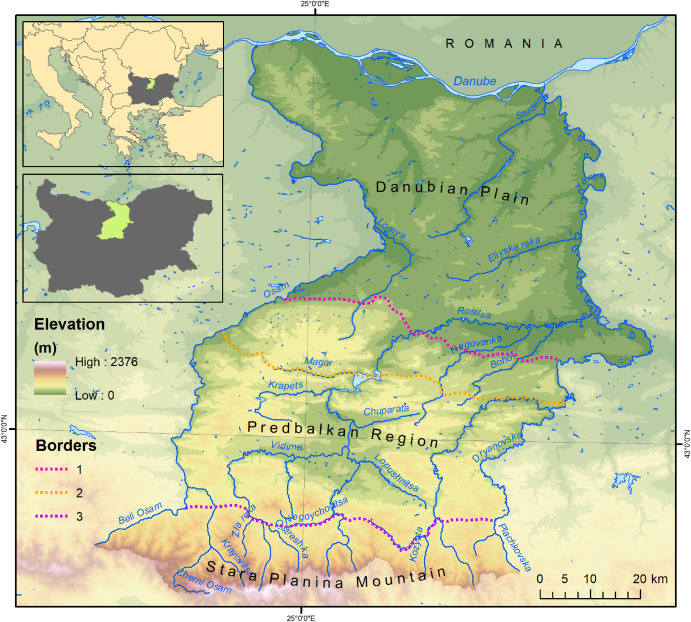
The approach of defining landscape patterns based on climate indices is applied in a case study area in North-Central Bulgaria. The results proved the strong interrelation between the climate indices and the elevation, enabling the implementation of a regression model. The results of the regression are used to define threshold values for delineation of all potential contours based on climate indices. The GIS modelling enables the integration of the results from different indices for the delineation of landscape contours of five potential landscape types. Four of them are validated with higher precision, proving the approach’s applicability. One of the main capacities of the proposed approach is the opportunity for reconstructing climax vegetation and furthermore, the climax ecosystems that form the matrix of the potential landscapes. This can significantly contribute to assessing ecosystems and their services for restoration measures and implementing nature-based solutions.
Recent Posts
- Twenty years of ecosystem services research in Bulgaria: lessons learned and future directions from a geographical perspective 15/02/2025
- The old good landscape maps: New interpretations enabling ecosystem services assessment of conservation potential at a national scale 15/02/2025
- GIS-based modelling of landscape patterns in mountain areas using climate indices and regression analysis 15/02/2025
Bulgaria Climax vegetation Cultural services de Martonne aridity index digitization Ecosystem Services GIS landscape classification landscape heterogeneity Landscape type literature review mapping mapping ES nature conservation provisioning services regulating services Selyaninov hydro-thermal coefficient spatial data Thornthwaite moisture index